
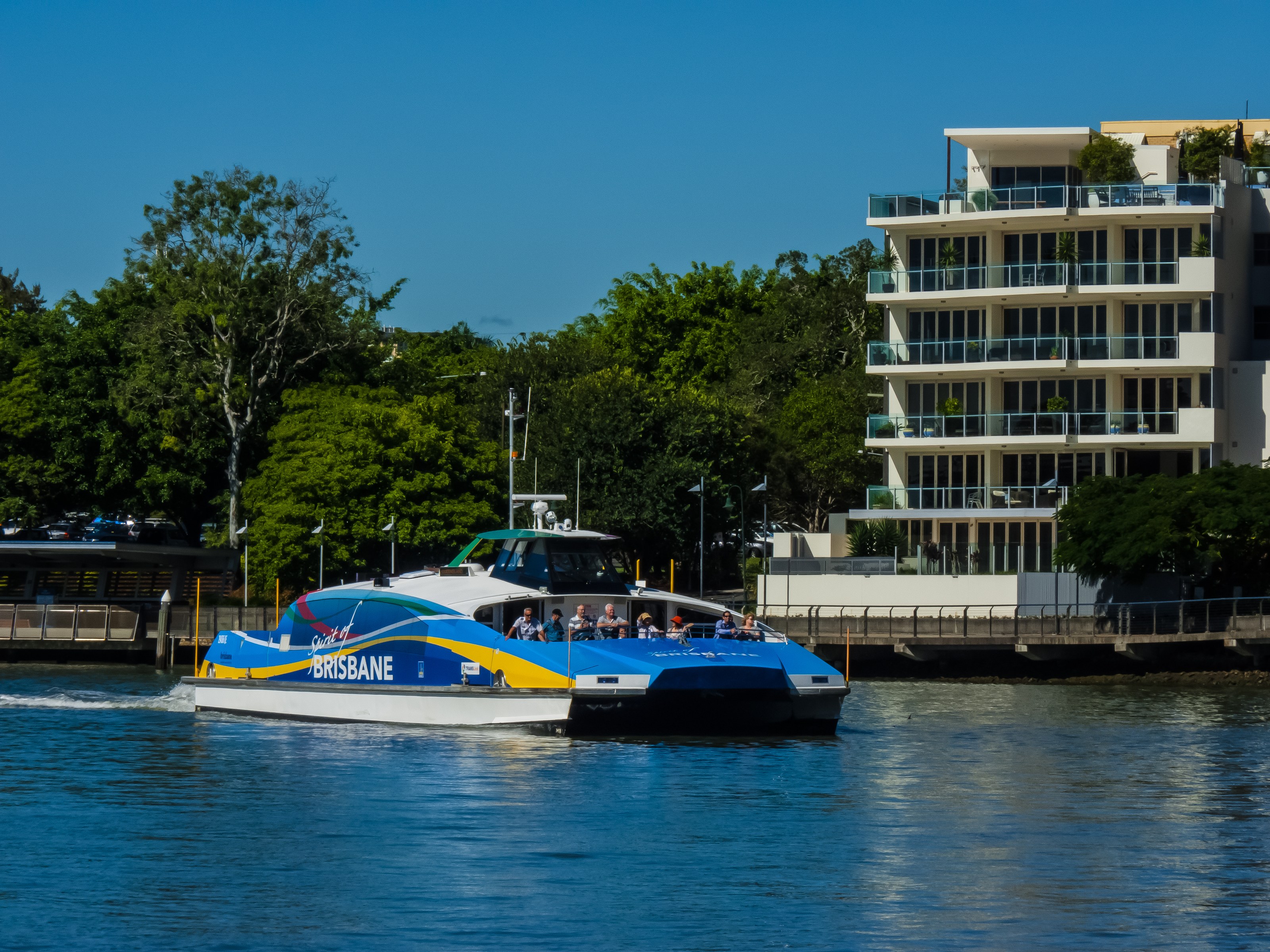
A river can divide a city on a map and connect it in daily life. Brisbane makes that distinction visible from the deck of a public ferry. The water curves; neighbourhoods appear, withdraw and return from a different angle. A journey that looks indirect on a street plan can become an intelligible sequence of landings, bridges and banks when travelled at river level.
The invitation is not to turn every commute into a sightseeing performance. CityCats carry people with appointments, shopping and ordinary reasons to get somewhere. Their interest for a visitor lies partly in that normality. Boarding a scheduled service places the river inside the working city, rather than beyond it as a separate excursion.
Read the route before boarding
Brisbane City Council describes an all-stops CityCat service between the University of Queensland at St Lucia and Northshore Hamilton, alongside express and cross-river services. These are not interchangeable boats. A vessel travelling in an appealing direction may skip the landing you want, and a crossing can solve a different problem from a longer journey along the bends.
Use the current Translink planner to choose the boarding point, destination and return before setting out. Check the terminal name carefully, then look at how you will reach it on foot. A line on the river does not tell you the gradient of the approach, the condition of a connecting path or the effect of a temporary terminal closure.
Leave enough margin to miss one service without losing the day. That small adjustment changes the mood of the journey. You can allow other passengers to disembark, follow the crew's instructions and settle into the available space without treating the timetable as an obstacle course. The public service remains useful when visitors behave like considerate passengers.
A modest fare, clearly understood
At the time of research, Translink lists a flat fare of fifty Australian cents per journey on its network, including Brisbane City ferries. Its published exclusions include Airtrain. The price is striking, but the useful detail is the payment rule: tap on and off correctly, using the same card or device. A phone and the physical card linked to it are not interchangeable at the reader.
Check the current conditions before travelling, particularly if combining modes or relying on a concession. Do not assume that all boats on the river share the public-network fare. A sightseeing cruise, private transfer or other operator may be a different product entirely. This article proposes a public-transport journey, not an unverified cruise package.
The practical saving can be spent in attention rather than in more stops. Choose two places you genuinely want to understand and allow the crossing between them to remain part of the day. An inexpensive service does not need to become an invitation to race repeatedly from one landing to another.
What a moving viewpoint changes
From a ferry, buildings are seen in relation to their banks rather than their street addresses. Some frontages meet the water directly; others sit behind paths, planting or infrastructure. Bridges pass from distant marks to overhead structures. The curve of the river prevents a single view from explaining everything at once.
That is useful for a visitor accustomed to collecting skyline photographs. A moving viewpoint replaces the search for one definitive picture with a series of partial ones. Put the camera down between them. Notice where passengers leave and where the river offers a connection that the street network makes less obvious.
The archive hero photograph shows a CityCat on the river in 2012. It establishes the subject, not the exact vessel you will board or the current appearance of every bank behind it. Brisbane's transport and waterfront continue to change. A dated photograph can be a companion to a present-day journey without pretending to be a live report.
Walking is a different reading
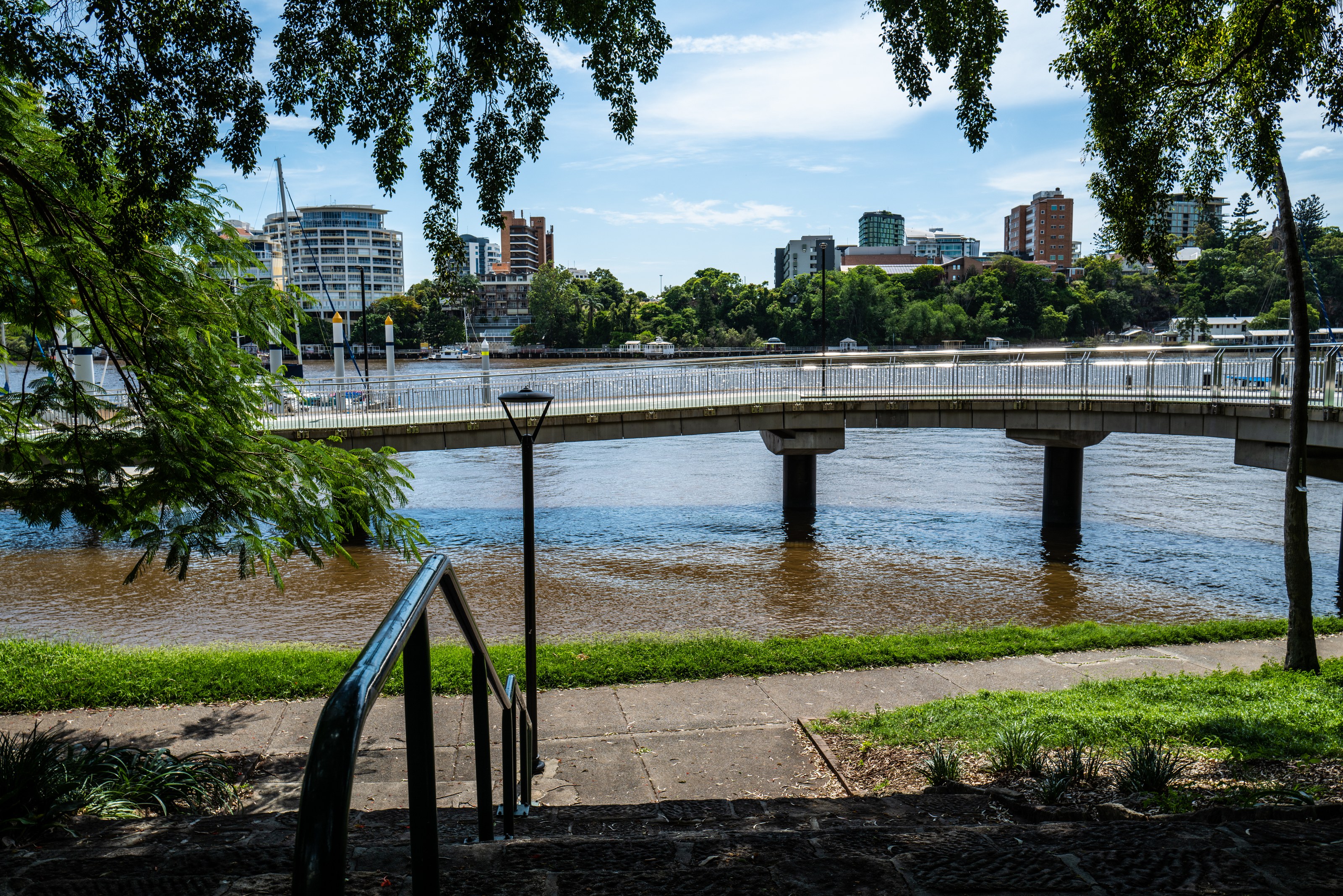
Pair a ferry leg with a short walk rather than trying to experience the whole waterfront from one mode. The City Botanic Gardens offer a riverside setting where attention can shift from movement to shade, paths and the relationship between planted ground and water. Council identifies the gardens as a historic landscape, with roots in the early penal settlement and a botanic reserve declared in 1855.
Those origins deserve more than a passing label. A garden can be both a welcome public space and a landscape shaped by colonial decisions about land, plants and work. Enjoying its shade does not require describing the site as if its history began with recreation. Look for interpretation, and distinguish what it explains from what a photograph merely suggests.
The inline image belongs to the gardens' own riverwalk. It should not be confused with the New Farm Riverwalk farther along the river. Keeping that distinction clear matters when planning a route: similar waterfront vocabulary can hide separate locations, different approaches and a much longer walk than expected.
An edge rebuilt after water rose
The New Farm Riverwalk is another possible outing, subject to current access. Brisbane's visitor information describes the loss of the original floating route in the 2011 floods and the opening of its replacement in 2014. It also explains the separation of walking and cycling space. These are practical design choices, not simply details beneath a view.
A replacement structure should not be read as proof that the river has been made harmless. Flood resilience is not a guarantee of uninterrupted access during severe weather. The city publishes emergency information because a route that is comfortable in ordinary conditions may become inappropriate when conditions change.
The broader lesson is visible without seeking dramatic evidence of disaster. A riverside path exists through a continuing negotiation with water, not a final victory over it. Stay on the designated side of a divided path, leave space for people passing and obey closures even if the next section appears dry. A barrier can reflect a hazard farther ahead or an inspection that has not yet been completed.
The river's difficult archive
Historical accounts of Brisbane's floods include ships stranded in the City Botanic Gardens in 1893. The Museum of Brisbane uses that episode to connect photographs, the movement of water and the labour of recovery. It is an arresting reversal: vessels intended to move through the river became objects on land.
Use the story to enlarge your understanding of the site, not to turn disaster into entertainment. A riverside landscape contains histories of loss and disruption that are not visible during a pleasant visit. Modern emergency planning belongs in the same account as older photographs. Both resist the assumption that a familiar bank is a fixed boundary.
Before an outing, check Council's emergency dashboard and the weather forecast as well as the transport planner. If warnings or closures affect the route, choose an indoor day or another safe plan. There is no obligation to complete a river-themed itinerary merely because it has already been saved.
A day with two good connections
A considered plan needs only a confirmed ferry journey, a manageable walk and a comfortable return. Carry water and sun protection, allow for rain and heat, and identify somewhere to pause indoors. Accessibility needs should be checked for the whole chain: approach, terminal, vessel, landing and onward path, rather than inferred from one accessible component.
That scale leaves room for the ordinary city. A river trip can include a destination without turning every stop into a headline. What remains afterwards may be the understanding of a bend, the position of a garden or the way a landing connects to a street.
Brisbane's river is most revealing when it is allowed to be useful. It carries journeys as well as views, and its edges require care as well as admiration. Board with a destination, keep the return flexible, and let the route explain the city between the two.
“A river can divide a city on a map and connect it in daily life.”
A considered route
- PlanConfirm a real connection
Select two terminals in the current planner, including approach and return, rather than boarding by appearance.
- PauseWalk a manageable garden route
Visit the City Botanic Gardens if conditions and access suit; recognise colonial origins alongside today's public use.
- DecideKeep the next leg optional
Add a separate New Farm walk only after checking access, weather and distance; an indoor alternative is a valid change.