
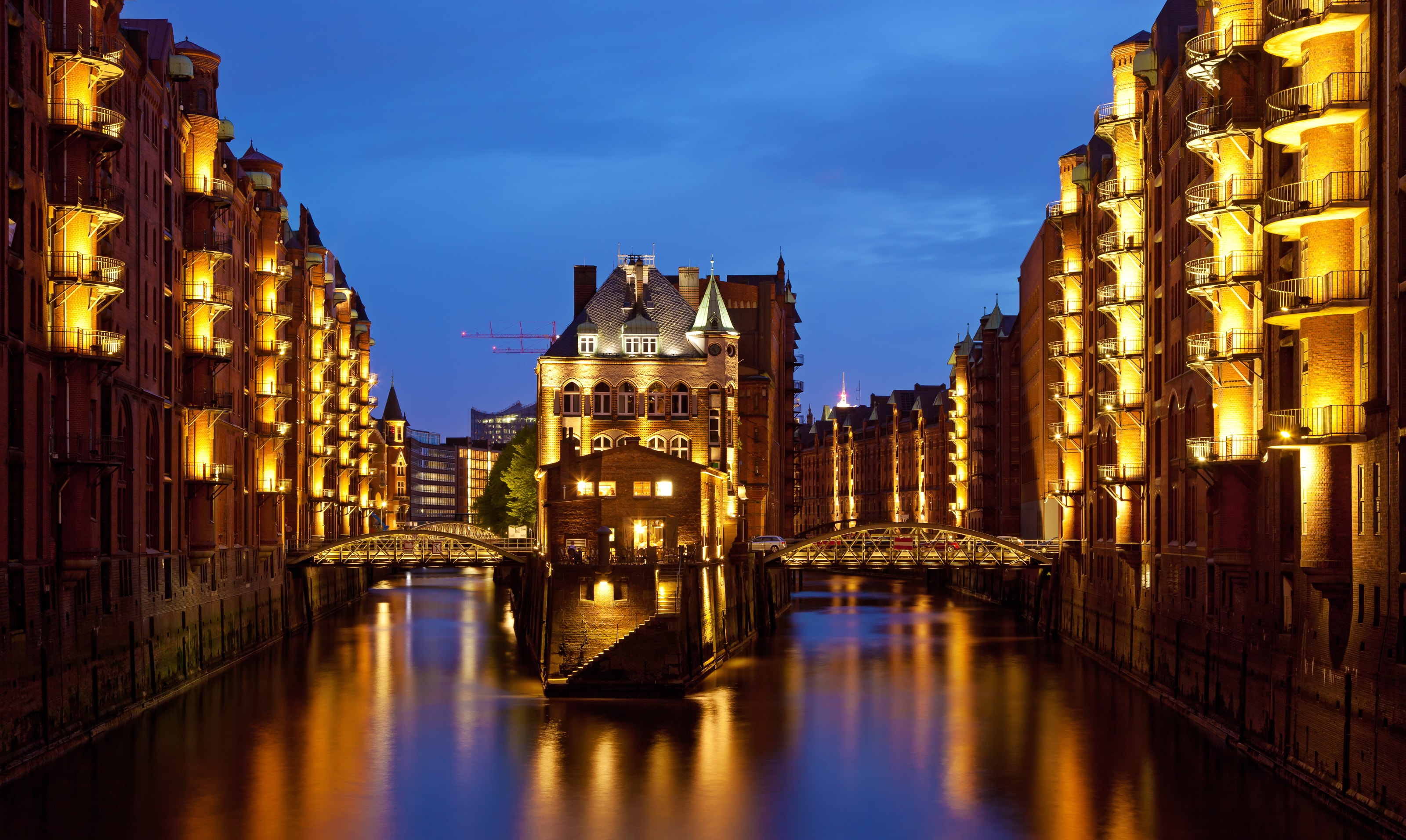
A photograph of Hamburg's Speicherstadt often settles on the brick warehouses, a bridge and their reflections. It is a persuasive image, but it leaves an important part of the scene unstated. The water belongs to a port city, and the port operates within the conditions of a tidal river. Looking closely means holding the architectural composition and the working waterway in the same account.
Begin with the warehouses in daylight if you can. Evening photographs are beautiful records of particular moments, not a promise about tonight's lighting, weather or access. In daylight, the relation between buildings, bridges, streets and canals can be easier to follow. A visitor does not need specialist knowledge to notice the difference between a building designed to store goods and one designed primarily to be seen.
Brickwork with a commercial purpose
UNESCO describes Speicherstadt as a coherent warehouse ensemble developed between 1885 and 1927, with parts rebuilt after the war. Nearby, the Kontorhaus district contains large office complexes for port-related businesses. The two areas belong together in the heritage account: goods required storage, while trade required administration and commercial offices.
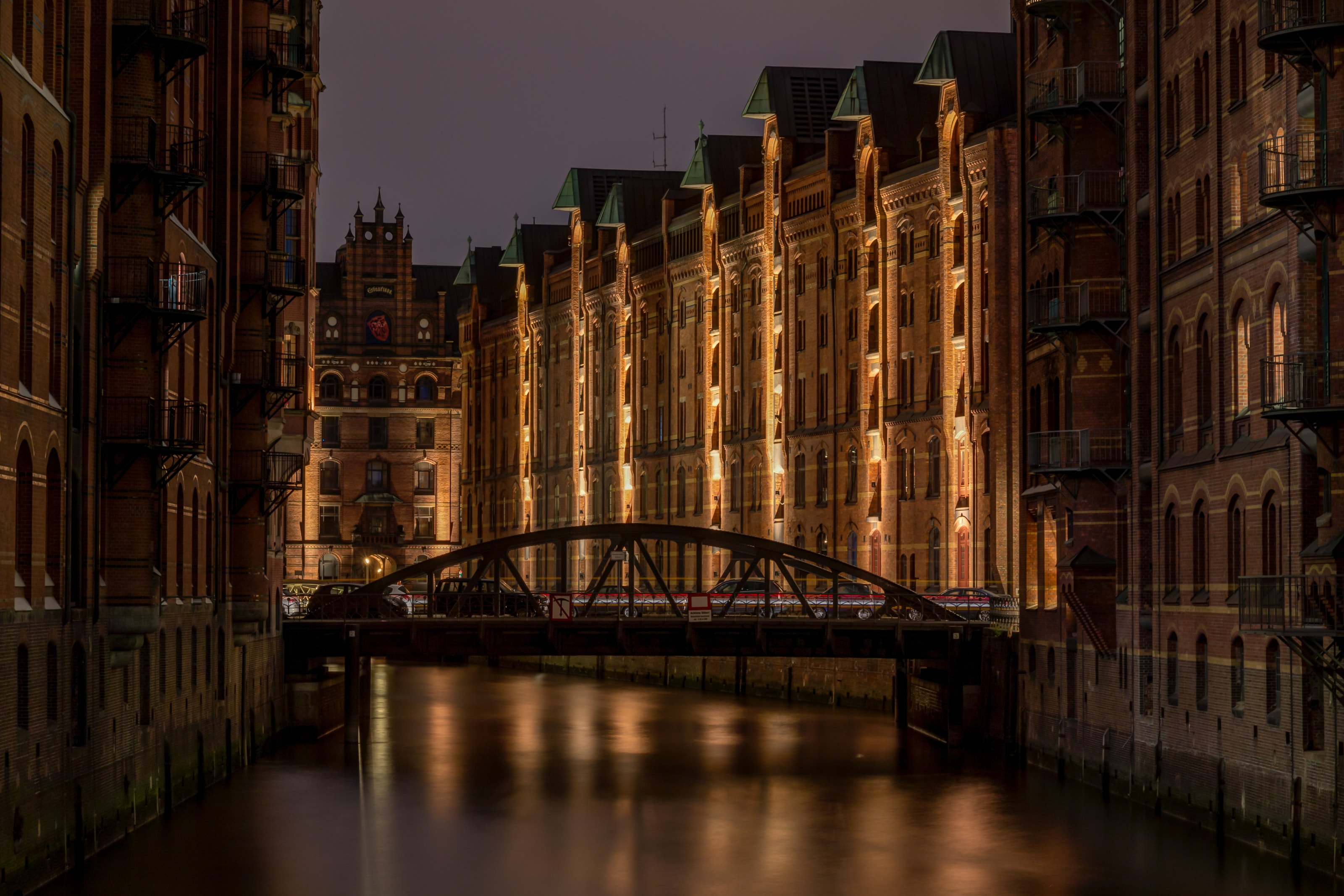
Keep that distinction in mind during a walk. A warehouse frontage can be read through repetition: levels, openings and the relationship to a canal. An office building asks a different set of questions about entrances, circulation and the presentation of a business. Neither becomes more interesting by pretending that all the buildings served the same picturesque function.
The surviving architecture also deserves a chronology more careful than the word untouched. Construction, wartime damage, rebuilding and changing use are part of the place. A restored feature need not be dismissed as inauthentic, but an account should not quietly substitute a timeless image for a documented history. Look for an explanatory sign or a museum label when the detail matters.
Give the blocks room
Speicherstadt is best approached as a connected district rather than a queue of individual photo opportunities. Select a short circuit on public streets and bridges. Pause where the view changes, then turn back towards the buildings nearest you. A canal vista explains the ensemble; the nearer wall reveals the scale of a repeated window or the relation between one level and another.
Keep private entrances and service routes clear. A warehouse district is not transformed into unrestricted public space by appearing in a guidebook. If a museum or other interior is part of the plan, check that particular venue's current admission and opening arrangements. A cluster of attractions on a map does not mean their tickets, hours or access conditions are shared.
There is a useful discipline in choosing one interior rather than treating the district as a race through several. Read enough about it beforehand to know what question you want it to answer. A display about goods, shipping or customs will offer a different perspective from an architectural walk. Let the difference remain visible instead of asking each stop to tell the whole story of Hamburg.
The office district belongs in the picture
It is easy to give all the attention to water and leave the Kontorhaus district as an afterthought. That would remove half the argument. UNESCO links the warehouse and office ensembles to the expansion of international trade. The districts make visible different parts of the same commercial system: the movement and storage of material, and the organisation of transactions.
The comparison can be made without turning the walk into a catalogue of architectural labels. Notice how a building announces its entrance, what kind of frontage it presents to the street, and how large it feels at walking pace. Allow the street to be the classroom. Specialist dates and styles can be followed up later, while the relationship between form and purpose remains available to anyone prepared to look.
Trade, of course, is not an entirely neutral subject. An attractive warehouse does not by itself explain the conditions under which goods were produced or the distribution of profit and labour. Seek out interpretation that asks those questions when it is available. Avoid filling a gap in the evidence with a romantic story about merchants and distant places.
A ferry is public transport
For a second perspective on the river, consult HADAG's current routes. Its ferries form part of Hamburg's public-transport network. The operator lists route 62 between Landungsbrücken and Finkenwerder, among other services. This makes a ferry a practical possibility for a river journey, but not an automatic substitute for a guided harbour tour.
Those are different products. Public transport follows an operating route and serves people making ordinary journeys; a sightseeing tour may provide a different itinerary or commentary. Choose according to the purpose of the trip, check ticket validity with HVV and HADAG, and read live service information before leaving for the landing.
On board, keep boarding areas clear, follow crew instructions and make room for passengers who are travelling rather than sightseeing. Do not plan the last feasible return as if it were a guaranteed private transfer. Leave time for an alternative and know how to make the onward journey if a stop changes. The view is a welcome part of the journey, not a reason to forget that the vessel has an operating schedule.
The tide can edit the route
Water levels have practical consequences. HADAG describes circumstances in which high water prevents a ferry serving a particular landing. The Hamburg Port Authority likewise warns that flood-defence measures do not remove every risk from storms and high water. These are operational facts, not invitations to seek out dramatic conditions.
For visitors, the appropriate response is straightforward: check current alerts, respect barriers and abandon a waterside route when officials or operators say it is unsuitable. A saved map is not permission to use a closed path. Nor should a photograph of an accessible quay in another year be used as evidence that the same approach is open today.
Make an indoor alternative before the weather becomes a problem. It can be as simple as one museum you actually want to visit, with its opening arrangements checked, followed by a shorter walk if conditions improve. There is no lost authenticity in allowing a working river's conditions to govern the day. Ignoring them would be the less accurate way to experience a tidal city.
A route with breathing space
Give the warehouse and office districts a substantial first interval, separated by time to sit and eat. Keep a ferry journey as a second, independently checked part of the day, or move it to another day entirely. This prevents an interesting stop on land from becoming an inconvenience because the next connection has already taken control of the afternoon.
Budget in euros. Outdoor observation, paid interiors, transport and food should be counted separately. If you use a day ticket or other transport product, confirm its area and mode validity rather than assuming that the word harbour means every boat is included. Travellers with access requirements should check the individual boarding point and service; a waterside route may present a different challenge from a station platform.
Before leaving, return to the idea behind the familiar photograph. The brick, bridges and reflected light are still there to be appreciated. What has changed is the account around them: a district of storage and offices, a river carrying other people's journeys, and a tide that cannot be reduced to decoration. Hamburg becomes richer when its water is allowed to remain a working condition rather than a background.
“Hamburg becomes richer when its water is allowed to remain a working condition rather than a background.”
A considered route
- First intervalWarehouse district
Follow a short public-street circuit and compare long canal views with nearby building details.
- Second intervalCommercial offices
Continue to the Kontorhaus district to read the office buildings alongside the storage district.
- Optional extensionA public ferry
Use current HADAG information and leave a return margin; substitute an indoor visit when conditions require.