
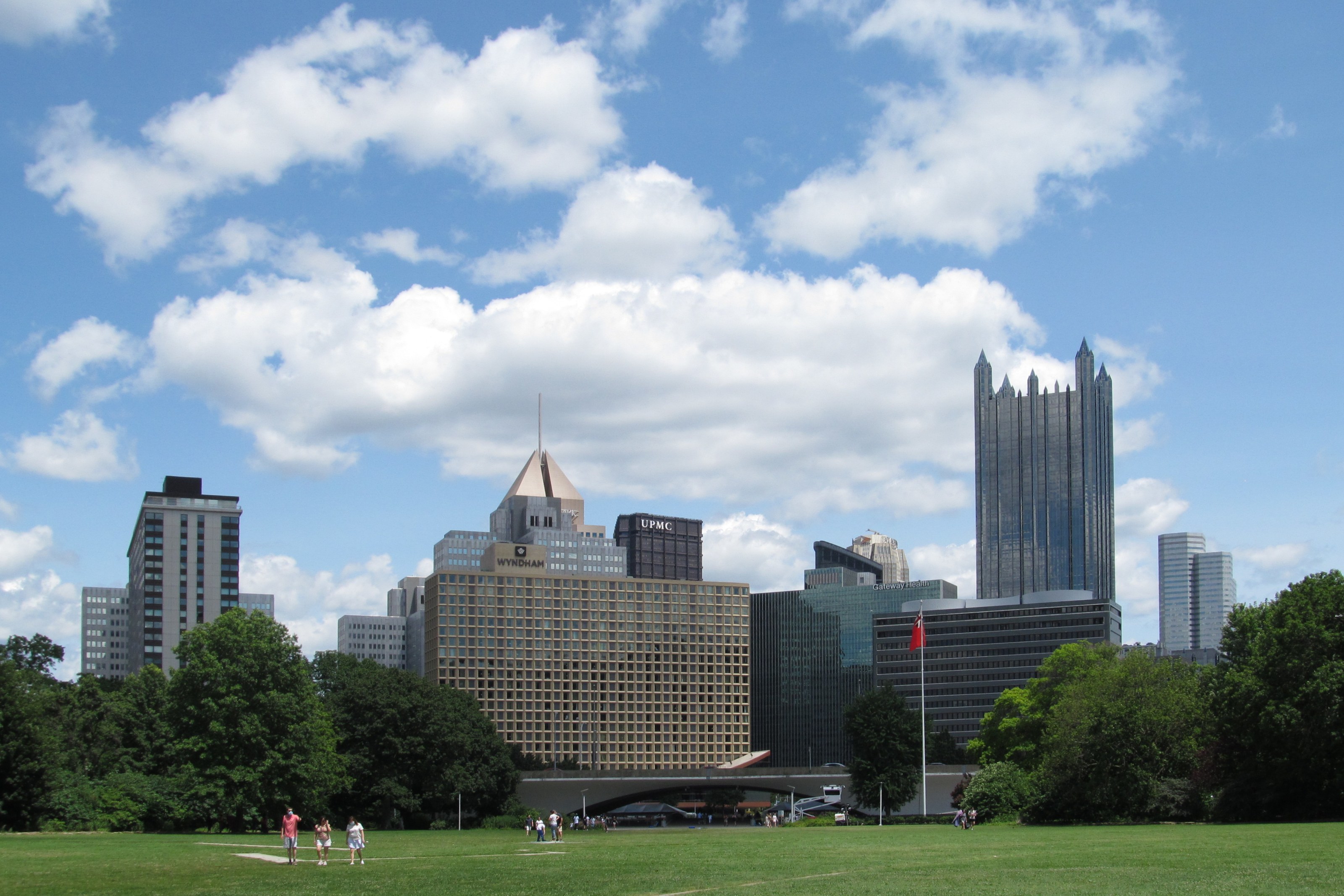
At the tip of Point State Park, the map becomes a physical proposition. The Allegheny and Monongahela meet, and the Ohio continues away from their confluence. Downtown rises behind the open ground. Roads and bridges frame the approaches. Pittsburgh's celebrated river view is not a pause outside the city: it is a place where its geography, transport and contested history are compressed into a single field of vision.
A photograph can make the meeting of the rivers appear effortless. A visit is more rewarding when it slows that impression down. Which bank are you on? Where can you cross? What occupied this ground before it became a park? And who maintains the paths that let a traveller move beside water that has never existed solely for recreation?
Begin with direction
Before choosing a route, identify the two incoming rivers and the outgoing Ohio on a current map. The names matter because they turn an attractive panorama into a legible landscape. A trail described as riverside may follow a different bank from the one you intend. A bridge in the distance may not provide the pedestrian connection that a quick glance suggests.
Start inside the park with the ground rather than the skyline. Pennsylvania's conservation department describes Point State Park as a place preserving the strategic history of the Forks of the Ohio. Its public paths let you approach that history at walking pace. Open space also gives buildings room to be seen together, without requiring a climb, a rooftop booking or an elaborate transport plan.
The fountain is an important part of the park's image, but it should not carry the success of the visit. Seasonal operation, maintenance and current conditions can alter what is visible. The confluence remains the organising fact. If the fountain is not running, there is still a city to read rather than a failed photograph to replace.
More than the beginning of a city
The forts at the Forks were instruments of control over a much larger region. French and British military ambitions are one part of that account; Indigenous sovereignty and the consequences of settlement are another. A narrative that begins only when Europeans recognised a useful site turns an inhabited landscape into supposedly empty ground awaiting a city.
The Heinz History Center's account of the Delaware Treaty of 1778 offers a corrective to that habit. It describes negotiation at Fort Pitt, Delaware political choices and promises that were not fulfilled. The point is not to compress those events into a decorative paragraph beside a skyline. It is to recognise that a river junction could connect communities while also becoming a place where power was asserted against them.
Allow time for the Fort Pitt Museum if its current opening arrangements suit your day. The museum is a distinct visit, with its own admission rules; do not assume that entry is free because the surrounding park is public. Its exhibitions provide context that the open ground cannot supply alone. Read the language used to describe expansion, alliance and conflict, and notice whose decisions are placed at the centre.
A park is also a redesign
Today's open point is itself a historical intervention. The state account dates the park's completion and dedication to 1974, after a long process of redevelopment. Looking at the lawn as if it were the natural, inevitable end of the downtown streets misses that transformation. The apparent simplicity of an open vista was constructed.
That does not diminish the pleasure of being there. It makes the pleasure more specific. Space once used differently has become available for public gathering, looking and movement. At the same time, redevelopment stories deserve questions about what was removed and whose experience is least visible in the surviving view. An attractive outcome does not make every preceding decision uncomplicated.
Compare the park's openness with the layered infrastructure around it. Traffic does not cease because a visitor has reached the water. Bridges carry movement through the panorama, and the city's working systems continue beyond the frame. Pittsburgh is especially interesting when those elements are allowed to coexist in the description, rather than separated into an industrial past and a supposedly complete recreational present.
Choose a trail segment, not a mileage target
The Three Rivers Heritage Trail provides routes along the region's riverbanks, but it is a network, not a guarantee of an uninterrupted waterside stroll in every direction. Its steward, Friends of the Riverfront, publishes maps alongside trail alerts. Read both before choosing a segment: a route's line on the map and its availability on the day are different kinds of information.
Choose one manageable segment after checking the current map and alerts. A short return walk can offer more attention to the river than a complicated loop assembled from uncertain crossings. Give yourself time to read the trail's heritage signs where they are accessible. The interpretation belongs to the route, not merely to the destination at its end.
A recent closure notice shows why a continuous downtown riverfront walk should never be improvised from an old map. Friends of the Riverfront announced weekday daytime restrictions in front of the Convention Center for painting work, with an expected end date of 13 November, dependent on weather. That estimate is not evidence that the path has reopened, nor a reason to describe it as still closed for your visit. Check the steward's latest notice and follow any current signed alternative.
Bridges seen from below
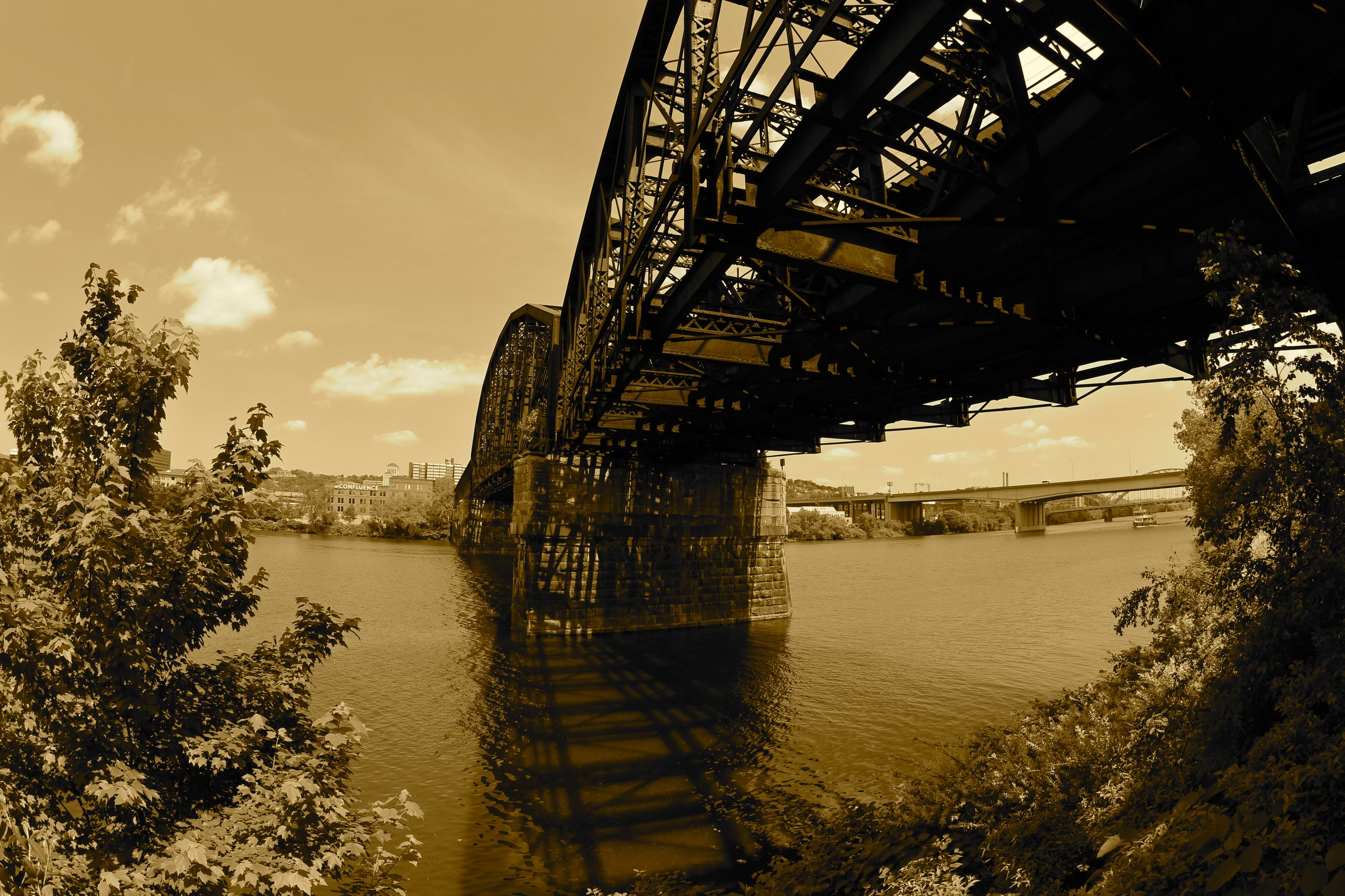
The accompanying archive photograph of a railway crossing offers another way to look at Pittsburgh. Beneath a bridge, structural depth replaces the thin line shown on a map. Supports, shadows and the relationship between deck and water become the subject. The photographer's sepia treatment is retained and identified; the image is not presented as evidence of current light or a current train service.
A bridge is also a boundary. Admiring railway infrastructure does not justify entering it, crossing a barrier or treating a maintenance track as a footpath. Keep the view from a lawful public position. If the best angle would require access that is not clearly permitted, choose another angle.
This restraint improves the walk. Instead of hunting the exact point from which somebody else's image was made, compare what different public positions reveal. From a distance, a crossing links two pieces of the city. Nearer the water, its mass may dominate the river edge. Both are true, and neither requires the landscape to become a private photographic set.
A sensible late-autumn day
Build the day around the park, one historical stop and one open trail segment. Check park advisories first, then the museum and trail information separately. Pennsylvania's current park guidance gives sunrise-to-sunset access, with day-use areas closing at dusk. That makes daylight a planning constraint rather than an atmospheric afterthought.
Carry a layer suitable for exposed river edges and leave room for an indoor break. Do not infer river safety from a calm-looking surface or add an unplanned paddling excursion to a walking itinerary. Water access requires its own equipment, conditions assessment and appropriate local guidance.
A good Pittsburgh river day finishes with clearer relationships, not necessarily more distance. The confluence explains why this ground mattered; the museum complicates the story of possession; the trail shows the work of making access possible. By the time you turn back towards downtown, the skyline has acquired a foreground. It is no longer simply a city beside three rivers, but a city whose choices can be followed along their edges.
“The skyline has acquired a foreground.”
A considered route
- OrientRead the Forks
Use a map to identify the incoming rivers and Ohio before choosing a bank or bridge.
- ContextGive history time
Check museum opening and admission independently of park access; do not treat the site as previously empty land.
- WalkSelect a verified segment
Consult the steward's current alerts and map; use only open trail sections and follow any signed detours.